Georeferenced Terrain Generation Add-On
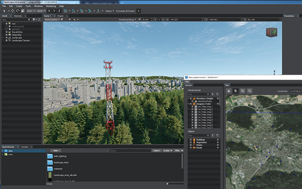
The Georeferenced Terrain Generation add-on provides a set of ready-to-use assets required for accomplishing the Georeferenced Terrain Generation tutorial in Sandworm. The pack contains the following assets:
- Elevation and Imagery data sources that are a part of the European Digital Elevation Model (EU-DEM), version 1.1, provided in the framework of the Copernicus programme funded by the European Union
- Landcover data prepared using data and information of the Corine Land Cover (CLC) 2006, version 18.5.1, provided in the framework of the Copernicus programme funded by the European Union
- Vector data sources provided by OpenStreetMap (www.openstreetmap.org)
- Nodes (including 3D models and textures) required for generation of vegetation, roads, fence, and GSM towers
Using Assets from Add-On#
To use the add-on:
- Download the Georeferenced Terrain Generation add-on from Add-On Store.
- Add the downloaded add-on (UPACKAGE file) to your project by dragging it into the project data/ folder in the Asset Browser. In the Import Package window that opens, click the Import Package button and wait until the add-on contents are imported.
- Follow instructions given in the tutorial and use assets stored in the sw_georeferenced folder.
The information on this page is valid for UNIGINE 2.20 SDK.
Last update:
2023-05-25
Help improve this article
Was this article helpful?
(or select a word/phrase and press Ctrl+Enter)