Importing Height Map from World Machine
Export Settings#
Dimensions#
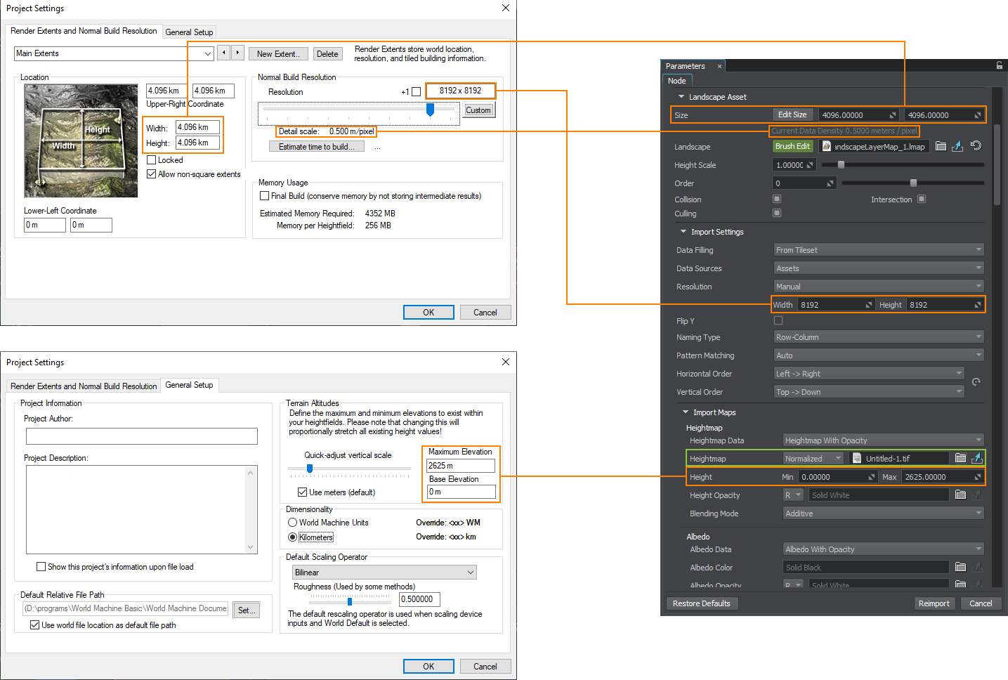
When exporting a heightmap from World Machine, pay attention to the following parameters (available via World Commands -> Project World Parameters…):
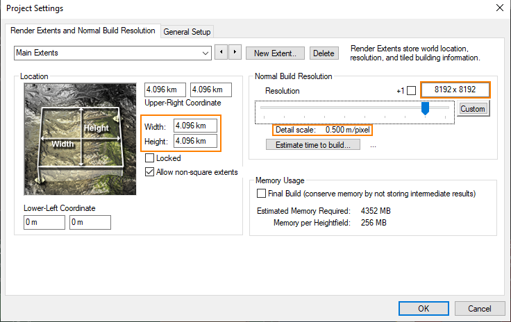
- Width and Height define the physical size in kilometers.
- Resolution sets the size of the output heightmap in pixels.
- Detail scale provides the info on the resolution of the output heightmap, i.e. how many meters there are in one pixel.
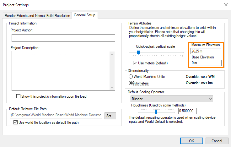
Elevation is available in the General Setup tab of the Project Settings window.
Tiling#
For large-scale terrains (more than 8K), export in tiles is recommended, this helps to avoid RAM limitations, especially when using 32 bit textures. The minimum recommended tile size is 1024 to avoid visual tiling artifacts. To do that, in the Project Settings on the Tiled Build Options tab (available for the Professional Edition), set the Tile Resolution and the number of Tiles per Side, check the Final Resolution:
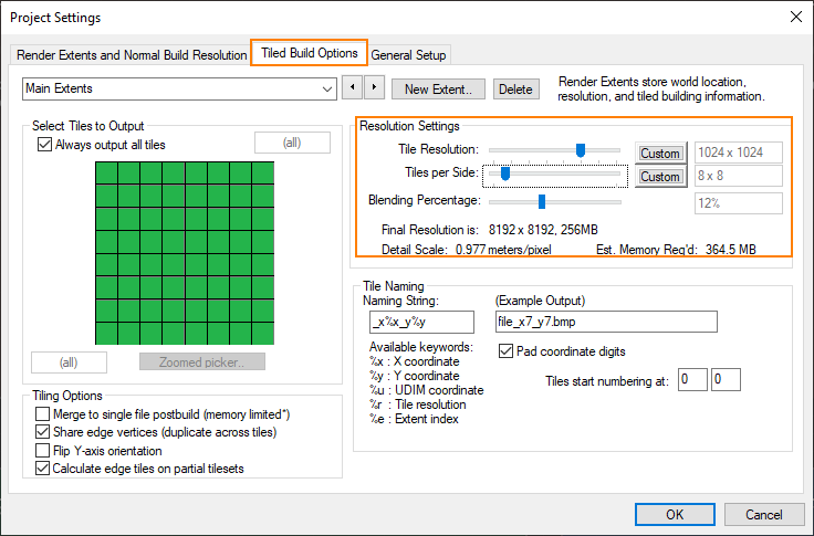
And export the height map by selecting Tiled Build:

Export Format#
In the Heightfield File Output settings, select the suitable export format. UNIGINE allows importing 8, 16, and 32-bit heightmaps.
Importing#
The exported heightmap is imported to UNIGINE as follows. In the Landscape Layer Map:
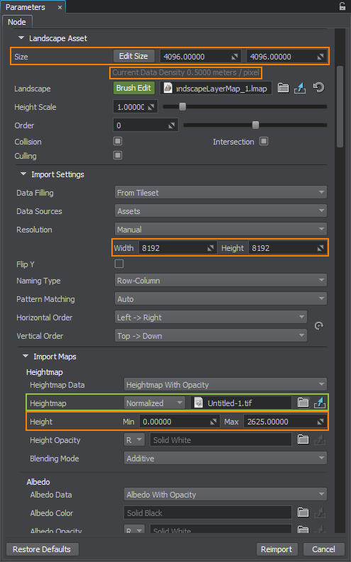
- In the Import Maps section, select the heightmap file you want to import.
- For the normalized heightmap, indicate the minimum and maximum heights taken from the Base Elevation and Maximum Elevation values.
- The unnormalized map does not require setting the height values.
- In the Landscape Asset section, set the actual size of your terrain in meters, the same as in Width and Height in World Machine.
- Check the Current Data Density value. It shows the meter-to-pixel ratio, and should correspond to the Detail Scale value.
- In the Import settings section, check the Resolution values. They define the resolution of the heightmap. They are set automatically in most cases, but can also be adjusted, if required.
If the heightmap is represented by a tileset, set the corresponding data-filling pattern.
Click Reimport.
The information on this page is valid for UNIGINE 2.20 SDK.