This page has been translated automatically.
Видеоуроки
Interface
Essentials
Advanced
Полезные советы
Программирование на C#
Принципы работы
Свойства (properties)
Компонентная Система
Рендер
Физика
Редактор UnigineEditor
Обзор интерфейса
Работа с ассетами
Настройки и предпочтения
Работа с проектами
Настройка параметров узла
Setting Up Materials
Setting Up Properties
Освещение
Landscape Tool
Sandworm (Experimental)
Использование инструментов редактора для конкретных задач
Extending Editor Functionality
Встроенные объекты
Nodes
Effects
Decals
Light Sources
Geodetics
World Objects
Sound Objects
Pathfinding Objects
Players
Программирование
Основы
Настройка среды разработки
Примеры использования
UnigineScript
C++
C#
Унифицированный язык шейдеров UUSL
File Formats
Rebuilding the Engine Tools
GUI
Двойная точность координат
API
Containers
Common Functionality
Controls-Related Classes
Engine-Related Classes
Filesystem Functionality
GUI-Related Classes
Math Functionality
Node-Related Classes
Objects-Related Classes
Networking Functionality
Pathfinding-Related Classes
Physics-Related Classes
Plugins-Related Classes
IG Plugin
CIGIConnector Plugin
Rendering-Related Classes
Работа с контентом
Оптимизация контента
Материалы
Art Samples
Tutorials
Внимание! Эта версия документация УСТАРЕЛА, поскольку относится к более ранней версии SDK! Пожалуйста, переключитесь на самую актуальную документацию для последней версии SDK.
Внимание! Эта версия документации описывает устаревшую версию SDK, которая больше не поддерживается! Пожалуйста, обновитесь до последней версии SDK.

Configuring Landscape Terrain Details

Details serve to achieve realistic visual representation of the Landscape Terrain in close up views.

See Also#

Details#

ObjectLandscapeTerrain stores visual settings for 20 detail masks intended for reaching better level of visual quality in close up views. Details represent arbitrary albedo, roughness and height (displacement) data, so you can drastically improve the look of the landscape terrain. Details are applied according to masks of Landscape Layer Map objects.

Notice
If your project requires detection of collisions with the terrain surface, you should keep in mind that Details don't participate in Intersection and Collision Detection, so it's not recommended to apply intense displacement using details since visual inconsistency may appear.

Detail settings available in ObjectLandscapeTerrain parameters allow defining the detail visual appearance, adding up to 1024 details to a mask and defining the material of each detail.
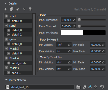
Detail parameters are available on the Node tab of the ObjectLandscapeTerrain parameters.

By combining multiple details under a single mask you can diversify the look of the surface a lot.
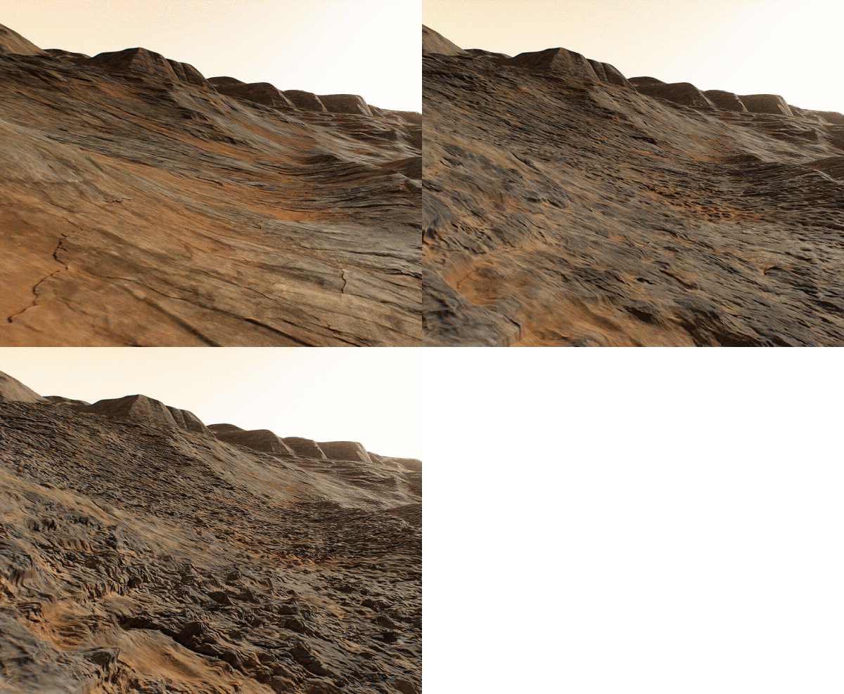
The result of combining three details under a single mask.

The list of detail masks displays the hierarchy of details for each of 20 detail masks. Using buttons at the top you can:

  • create details for all selected masks.
  • clone the selected details.
  • move up the selected details.
  • move down the selected details.
  • delete the selected details
Drag details using the mouse to set up the hierarchy, Double-click on a detail or a detail mask to rename it.

Detail parameters allow applying additional masking:

Mask Threshold Threshold starting from which the mask starts to be rendered.
Mask Contrast Contrast of the mask. For each mask you can set a Dither amount enabling you to reduce graphical artefacts in case of increased Mask Contrast value set per-detail. This Dither amount is multiplied by the global dithering amount.
Mask by Albedo Select an albedo color of Landscape Layer Masks in the world to be used as a mask. In this case, all areas on the terrain having selected color will be covered by the detail.
Notice
Control opacity by using the Alpha channel of the Mask by Albedo color.
Mask by Height This group of parameters is used for mask modulation. For the areas specified by the mask, you can set up the range of heights in which the detail is visible.
  • Min Visibility — minimum height value starting from which the detail mask begins to fade in until it becomes completely visible. The default value is -inf.
  • Max Visibility — maximum height value starting from which the detail mask begins to fade out until it becomes completely invisible. The default value is inf.
  • Min Fade — over this height range below the minimum height value the detail mask will fade in until it is completely visible. The default value is 0.
  • Max Fade — over this height range above the maximum height value the detail mask will fade out until it is completely invisible. The default value is 0.
Mask by Texel Size This group of parameters just like the previous one is used for mask modulation. For the areas specified by the mask, you can set up the range of texel sizes in which the detail is visible.
  • Min Visibility — minimum texel size value starting from which the detail mask begins to fade in until it becomes completely visible. The default value is -inf.
  • Max Visibility — maximum texel size value starting from which the detail mask begins to fade out until it becomes completely invisible. The default value is inf.
  • Min Fade — over this range below the minimum texel size value the detail mask will fade in until it is completely visible. The default value is 0.
  • Max Fade — over this range above the maximum texel size value the detail mask will fade out until it is completely invisible. The default value is 0.

The Detail Material section contains settings of the landscape_terrain_detail_base material assigned to the current detail.

Internally each Landscape Layer Map stores its 20 masks in 5 RGBA8 mask textures. The following parameters display the info on the corresponding mask texture and can be used to access the mask via API:

Mask Texture The index of the mask texture used.
Channel The channel of the mask texture used.
Last update: 24.11.2020
Build: ()