Port Angeles Workflow
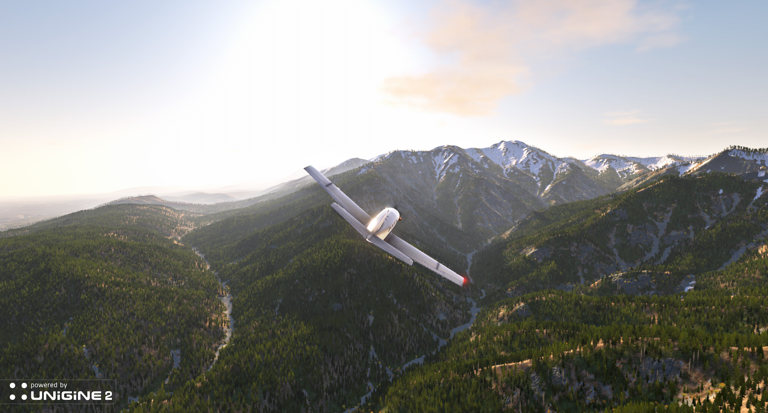
Port Angeles is a real-time 3D demonstration project powered by the cutting-edge UNIGINE Sim 2. The whole landscape, roadways, harbor, airport and natural objects were recreated by using real geographical data from the Port Angeles city (Washington, USA).
A Port Angeles demo features:
- Highly detailed terrain 50x50 square kilometers in size based on the real geospatial data
- Road network based on the vector geodata
- Dynamic sky with volumetric clouds and a day-night cycle
- Several interactive modes
- Airfield illumination
- Control by keyboard, XPad and touch screen interface
- Support for the multi-channel rendering mode
- Support for the curved screens projection
Overview#
Before going deeply to the details of project creation, lets examine all of the 3rd party applications used for content generation.
The workflow for terrain and vegetation is the following:
- Create a height map in Global Mapper.
- Download the terrain vegetation information from Land Cover and export it to images via Global Mapper.
- Create normals, terrain materials and object masks in World Machine.
- Import this data to the project via Landscape plugin.
The output data is presented as a terrain, grass, clusters, etc.
The workflow for cities is the following:
- Create street maps (roads, buildings, cars, etc.) in City Engine.
- Import this data to the project via the City Import plugin.
The output data is presented as decals, meshes, clusters, LODs, etc.
Natural Resources Generation#
Natural resources in terms of Port Angeles are presented as:
Terrain#
Terrain creation starts with the height map that defines a terrain relief. As the project is aimed to the real location in the Washington state, we used a Global Mapper GIS application to obtain a detailed spatial dataset of the required area.
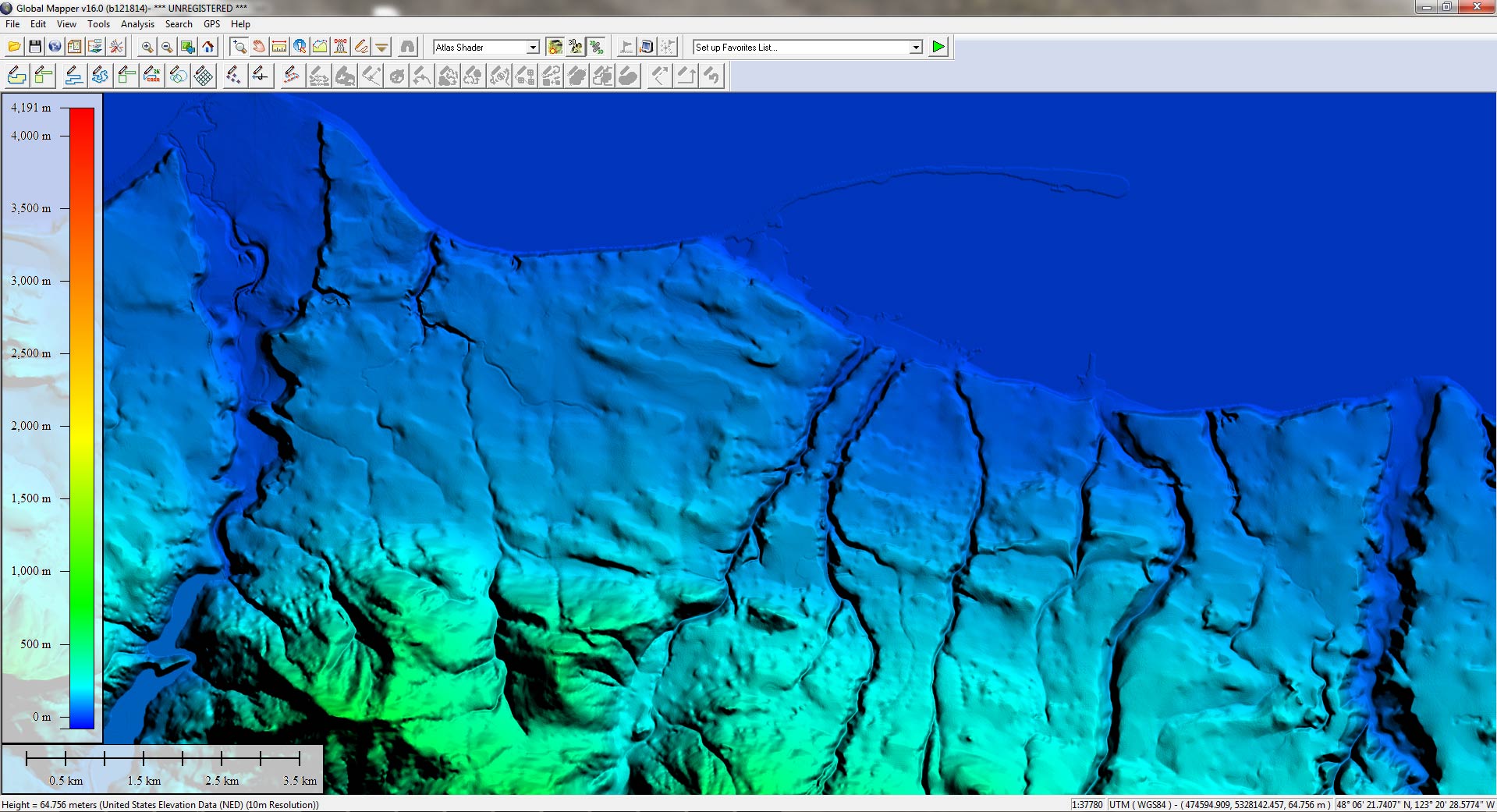
The height map was generated with regard to the following conditions:
- Used data source: U. S. Data / United States Elevation Data (NED) (10m Resolution).
- The set datum format WGS 84.
- The chosen projection is UTM. This projection is divided by zones and has the lowest distortion.
- The file is exported using tiling, as it is much easier to work with separate tiles of one big bitmap image.
Vegetation#
For terrain coverings in the scene to comply with real geodata, we used the corresponding information from the Land Cover tool.
Land Cover Data Viewer provides an access to the highly detailed information on land coverings of the United States. There are more than 100 different options of the possible ecosystems, describing the following coverings:
- Wood types (East Cascades Oak-Ponderosa Pine Forest and Woodland, North Pacific Oak Woodland, Northern Rocky Mountain Ponderosa Pine Woodland and Savanna, etc.)
- Rock types (Inter-Mountain Basins Cliff and Canyon, Rocky Mountain Alpine Bedrock and Scree, etc.)
- Shore types (Unconsolidated Shore, etc.)
This data is very helpful for artists when creating content.
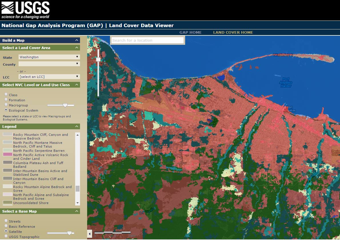
After the data is downloaded, it can be exported to UNIGINE-native formats via Global Mapper.
Cities Generation#
To import data on cities (including buildings, vehicles, roads, fences, etc.) you need to use an OSM application, for example, CityEngine. It provides an access to detailed large-scale 3D city models.
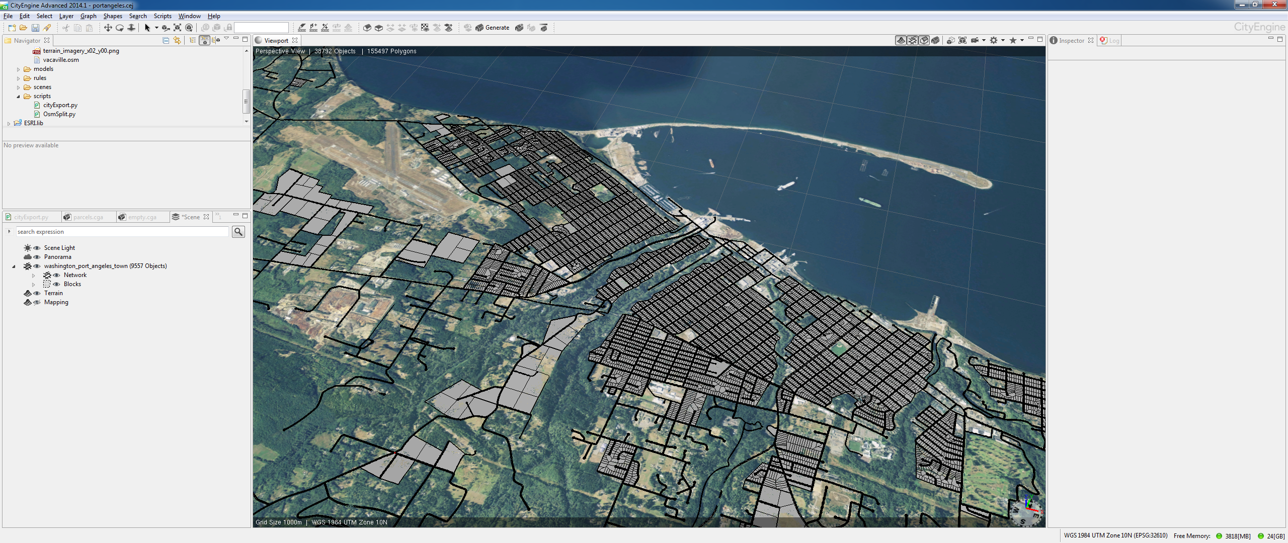
After the data is obtained, is must be converted to the .mesh format and .node formats.
Resulting data is imported to the engine by the City Import plugin.