Procedural City Generation Demo
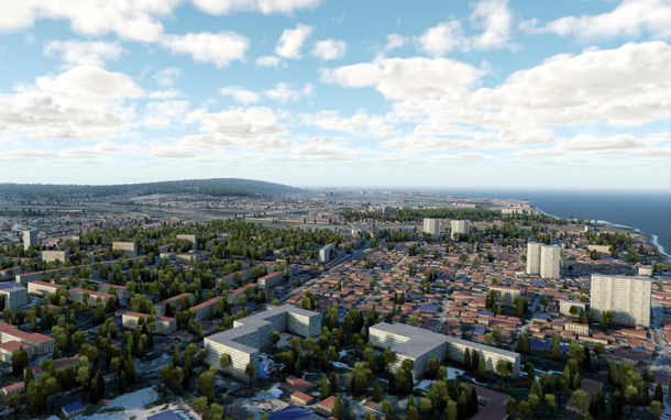
 Procedural City Generation demo showcases the Landscape Tool capabilities for procedural generation of buildings on a landscape. A fragment of the landscape with a city and vegetation was generated procedurally on the basis of GIS data provided by OpenStreetMap with no extra manual editing.Procedural_City_Generation演示展示了景观工具功能,用于建筑物的程序生成 在风景上。 根据 OpenStreetMap 提供的GIS数据,程序性地生成了带有城市和植被的景观片段,而无需进行额外的手动编辑。
Features特征#
- 10x10 km area near the Adler city (OSM imagery data)阿德勒市附近的10x10公里区域(OSM影像数据)
- Buildings generated on the basis of OSM vector data containing the number of floors根据包含楼层数的OSM矢量数据生成的建筑物
- Automatic texturing of buildings using 3 template materials使用3种模板材料对建筑物进行自动纹理化
- Vegetation generated on the basis of OSM landcover data基于OSM土地覆盖数据的生成的植被
- Global Water and a single Cloud LayerGlobal Water和一个Cloud Layer
最新更新:
2021-04-29
Help improve this article
Was this article helpful?
(or select a word/phrase and press Ctrl+Enter)