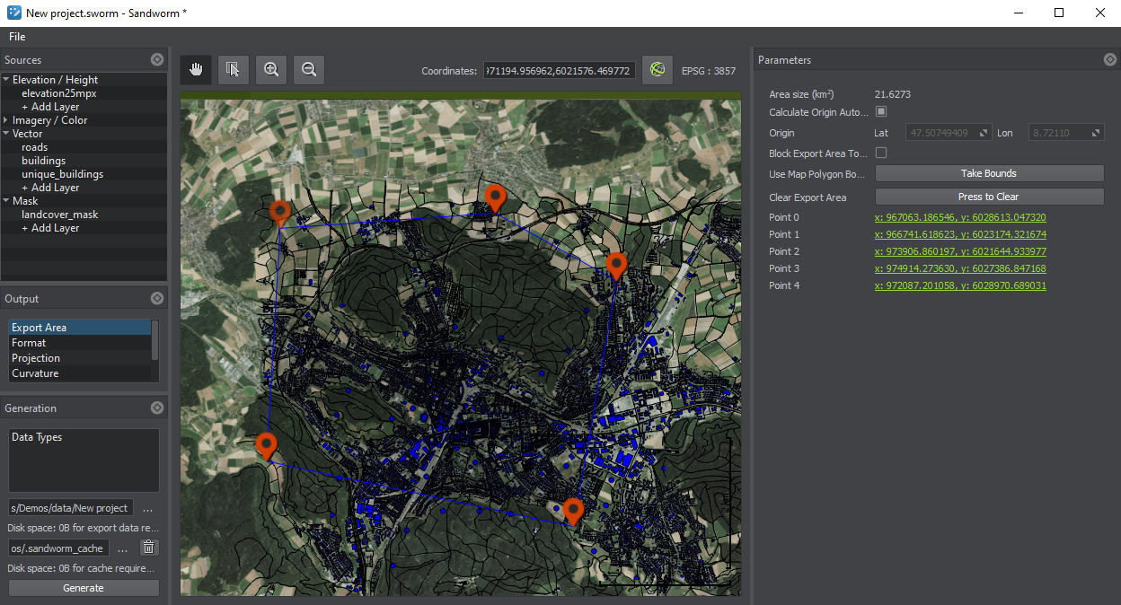
Export Area
Export Area is the arbitrary area that defines which part of the terrain is going to be generated.
To define this area, click on Export Area and set the points in the Preview panel by clicking the left mouse button. To delete a point, right-click on it and select Remove.
In the Parameters panel, the following is provided:
| Area Size | Displays the size of the selected area in square kilometers. |
|---|---|
| Calculate Origin Automatically | If enabled, the origin is calculated automatically based on the data provided. If the Export Area is changed and the terrain is regenerated, the origin would be updated automatically. |
| Origin | If Auto Calculate Origin is disabled, the origin latitude and longitude can be edited here, and they will not be recalculated automatically, if the Export Area is changed and the terrain is regenerated. |
| Block Export Area to Changes | If enabled, the selected Export Area cannot be modified. This option is useful, if you want to move around the map without occasionally shifting or modifying the export area. |
| Use Map Polygon Bounds | Makes the area visible in the Preview panel the Export Area. |
| Clear Export Area | Removes all the points that make the Export Area. |
| Point 0, Point 1, etc. | Coordinates of the points that define the Export Area. |
Notice
If the Export Area is not set, the terrain is generated based on all added data, i.e. the bounds of this terrain would be equal to the bounds of all added sources, and the origin is set to the center as relative to all added sources.
Last update:
2021-04-29
Help improve this article
Was this article helpful?
(or select a word/phrase and press Ctrl+Enter)