Importing Height Map from World Creator 2
Export Settings#
Dimensions#
When exporting a heightmap from World Creator 2, pay attention to the following parameters in the Base Properties panel:
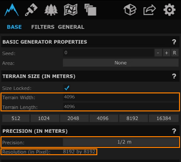
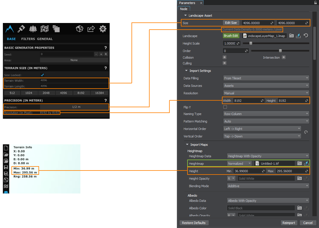
- Terrain Width and Terrain Length (in meters) define the physical size of the terrain.
- Precision defines the resolution of the output heightmap, i.e. how many meters there are in one pixel.
- Resolution (in Pixel) of the heightmap which is generated from the terrain.
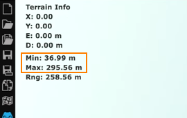
Check also the Min and Max height values of your heightmap in the top left corner. They are required, if you import your heightmap as normalized.
Tiling#
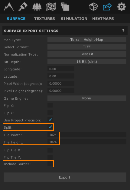
For large-scale terrains (more than 8K), export in tiles is recommended. This helps to avoid RAM limitations, especially when using 32 bit textures. The minimum recommended tile size is 1024 to avoid visual tiling artifacts. To do that, in the export settings for the heightmap, enable Split, define the Tile size (the power of 2), and disable Include Border:
Export Format#
When exporting the terrain, select the suitable export format. UNIGINE allows importing 8, 16, and 32-bit heightmaps.
Importing#
The exported heightmap is imported to UNIGINE as follows. In the Landscape Layer Map:
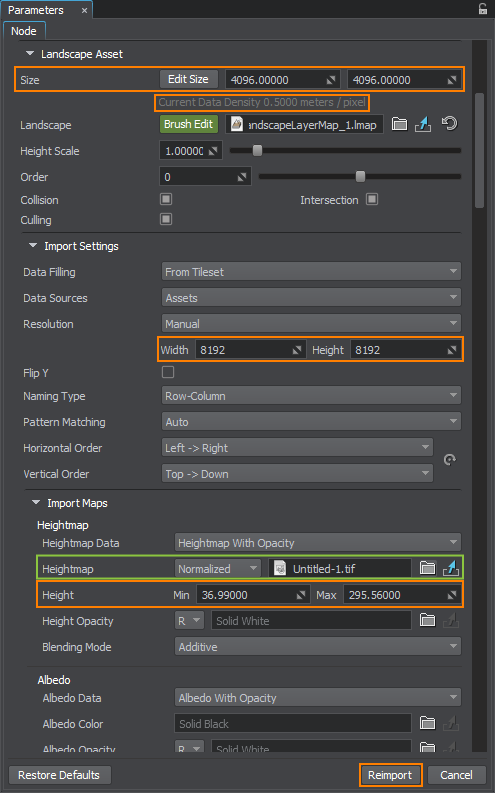
- In the Import Maps section, select the heightmap file you want to import.
- For the normalized heightmap, indicate the minimum and maximum heights taken from the Min and Max values.
- The unnormalized map does not require setting the height values.
- In the Landscape Asset section, set the actual size of your terrain in meters, the same as Terrain Width and Length in World Creator 2.
- Check the Current Data Density value. It shows the meter-to-pixel ratio, the same as Precision in World Creator 2.
- In the Import settings section, check the Resolution values. They define the resolution of the heightmap in pixels. They are set automatically in most cases, but can also be adjusted, if required.
If the heightmap is represented by a tileset, set the corresponding data-filling pattern.
Click Reimport.