This page has been translated automatically.
Видеоуроки
Interface
Essentials
Advanced
Подсказки и советы
Программирование на C#
Рендеринг
Принципы работы
Свойства (properties)
Компонентная Система
Рендер
Физика
Редактор UnigineEditor
Обзор интерфейса
Работа с ассетами
Настройки и предпочтения
Работа с проектами
Настройка параметров узла
Setting Up Materials
Setting Up Properties
Освещение
Landscape Tool
Использование инструментов редактора для конкретных задач
Extending Editor Functionality
Встроенные объекты
Nodes
Objects
Effects
Decals
Light Sources
Geodetics
World Objects
Sound Objects
Pathfinding Objects
Players
Программирование
Основы
Настройка среды разработки
Примеры использования
UnigineScript
C++
C#
Унифицированный язык шейдеров UUSL
File Formats
Rebuilding the Engine Tools
GUI
Двойная точность координат
API
Containers
Common Functionality
Controls-Related Classes
Engine-Related Classes
Filesystem Functionality
GUI-Related Classes
Math Functionality
Node-Related Classes
Objects-Related Classes
Networking Functionality
Pathfinding-Related Classes
Physics-Related Classes
Plugins-Related Classes
IG Plugin
CIGIConnector Plugin
Rendering-Related Classes
Работа с контентом
Оптимизация контента
Материалы
Art Samples
Tutorials
Внимание! Эта версия документация УСТАРЕЛА, поскольку относится к более ранней версии SDK! Пожалуйста, переключитесь на самую актуальную документацию для последней версии SDK.
Внимание! Эта версия документации описывает устаревшую версию SDK, которая больше не поддерживается! Пожалуйста, обновитесь до последней версии SDK.

Projection

Warning
The functionality described in this article is not available in the Community SDK edition.
You should upgrade to Engineering / Sim SDK edition to use it.

Output Projection is the projection to be used for the generated terrain. The set of options depends on the output format.

Object Landscape Terrain#

The generated terrain is exported to Object Landscape Terrain, which is actually a flat (i.e. not geospherical) area. Therefore, only projected coordinate systems are available for selection and can be used as export projections.

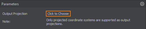
To choose a projection, click the corresponding button. The list of coordinate systems that can be used for projected output will open:

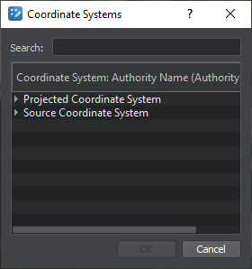
  • The Projected Coordinate System list contains a wide range of coordinate reference systems for projected output.
  • The Source Coordinate System list displays the coordinate systems used by your source data for convenience.

Select a projection by the double click, or just select by clicking once and press the OK button.

Notice
For the proper terrain generation, the coordinate system that encompasses all data sources should be selected. If the selected coordinate system does not include any part of the source data, the part of the terrain for such fragment will not be generated.

Terrain Global#

The following types of output projections are available:

  • Built-In (Geodetic Pivot) projection based on WGS-84 ellipsoid.
  • Custom projection that is used for data with a custom source projection (not WGS-84 ellipsoid-based). In this case, the projection is selected the same way as for Object Landscape Terrain.
    Notice
    The terrain generated using a custom projection cannot be curved.
Last update: 09.04.2021
Build: ()