Terrain Creation
To create a new flat terrain with the specified dimensions via UnigineEditor, do the following:
- Run UnigineEditor.
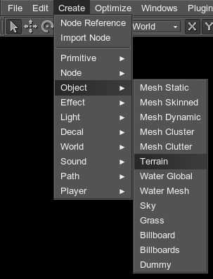
- On the Menu bar, click Create -> Object -> Terrain.

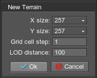
- In the dialog window that opens, specify the parameters and choose the path to the existing .terrain file to overwrite it, or choose the path to the new terrain.
- Place the terrain somewhere in the world.
See also a Landscape Plugin article to know more about creation of large terrains.
Terrain Parameters
The terrain is created with the following parameters:

| Name | Description |
|---|---|
|
X size Y size |
Terrain dimensions along the X and Y axes (i.e. how many grid cells there are along the X and Y axes). For example, if both parameters are set to 256, the terrain will have 16×16 grid cells. |
| Grid cell step |
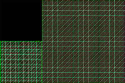
The step of a grid cell, in units. It determines how many times the terrain grid cell will be bigger than the default one (equal to one unit). At the picture below, both terrain have the same 256x256 dimensions, the step of the first terrain is equal to 1 unit, of the second to 2.

Notice
The parameter does not affect the storage size of the terrain, it just enlarges the terrain grid cell, so the amount of triangles remains the same. |
| LOD Distance | The distance to the first LOD that starts the distant-dependent tessellation. |
Notice
The terrain dimensions and grid step cannot be changed afterwards.
Last update: 2017-07-03
Help improve this article
Was this article helpful?
(or select a word/phrase and press Ctrl+Enter)