Georeferenced Terrain Generation Add-On
 The Georeferenced Terrain Generation add-on provides a set of ready-to-use assets required for accomplishing the Georeferenced Terrain Generation tutorial. The add-on contains the following assets: Georeferenced Terrain Generation附加组件提供了完成Georeferenced Terrain Generation教程所需的一组准备使用的资产。加载项包含以下资产:
- Elevation and Imagery data sources that are a part of the European Digital Elevation Model (EU-DEM), version 1.1, provided in the framework of the Copernicus programme funded by the European Union作为欧洲数字高程模型(EU-DEM)1.1版一部分的高程和图像(Elevation和Imagery)数据源是在由欧盟资助的哥白尼计划的框架中提供的
- Landcover data prepared using data and information of the Corine Land Cover (CLC) 2006, version 18.5.1, provided in the framework of the Copernicus programme funded by the European Union土地覆盖(Landcover)数据是使用由欧洲联盟资助的哥白尼计划框架提供的2006年Corine土地覆盖(CLC)版本18.5.1的数据和信息准备的
- Vector data sources provided by OpenStreetMap (www.openstreetmap.org)OpenStreetMap提供的向量(Vector)数据源(www.openstreetmap.org)
- Nodes (including 3D models and textures) required for generation of vegetation, roads, and GSM towers生成植被,道路和GSM塔所需的 节点(包括3D模型和纹理)
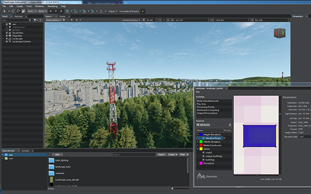
Using Assets from Add-On使用附加组件中的资产#
To use the add-on:使用附加组件:
- Install the Georeferenced Terrain Generation add-on (available via UNIGINE SDK Browser in the Add-Ons section) and add it to your project (by clicking Other Actions -> Configure Project -> Add-ons in the Projects section of UNIGINE SDK Browser).安装Georeferenced Terrain Generation附加组件(可通过Add-Ons部分中的UNIGINE SDK Browser获得)并将其添加到您的项目中(通过单击 Other Actions -> Configure Project -> Add-ons 在UNIGINE SDK Browser的Projects部分中)。
- Follow instructions given in the tutorial and use assets stored in the lt_georeferenced folder.
请遵循教程中给出的说明,并使用存储在lt_georeferenced文件夹中的资产。
注意It is recommended to move the Landscape Maps folder from the data/lt-georeferenced directory to another location outside the project data folder in order to avoid collisions between runtime files.建议将Landscape Maps文件夹从data/lt-georeferenced目录移动到项目data文件夹之外的其他位置,以避免运行时文件之间发生冲突。
It is recommended to move the Landscape Maps folder from the data/lt-georeferenced directory to another location outside the project data folder in order to avoid collisions between runtime files.建议将Landscape Maps文件夹从data/lt-georeferenced目录移动到项目data文件夹之外的其他位置,以避免运行时文件之间发生冲突。最新更新:
2021-12-13
Help improve this article
Was this article helpful?
(or select a word/phrase and press Ctrl+Enter)