Projection
You should upgrade to
In this section you select the projection to be used for the generated terrain and the required alignment of axes in the coordinate system.
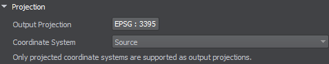
Output Projection#
The generated terrain is exported to Object Landscape Terrain or Object Terrain Global, which is actually a flat (i.e., not geospherical) area. Therefore, only projected coordinate systems are available for selection and can be used as export projections.
To choose a projection, click the corresponding button. The list of coordinate systems that can be used for projected output will open:

- The Projected Coordinate System list contains a wide range of coordinate reference systems for projected output.
- The Source Coordinate System list displays the coordinate systems used by your source data for convenience.
Select a projection by double click, or just select by clicking once and press the OK button.
Coordinate System#
The result of data transformation using the selected projection sometimes may not coincide with the internal UNIGINE axis alignment (East(x), North(y)). In such a case, the generated terrain might differ from the preview (i.e., East and West switched). To fix this, set the Coordinate System to Source.
- Source — the orientation of the generated terrain is in accordance with the alignment indicated in the projection.
- World — the generated terrain is aligned as East(x), North(y).
Built-In (Unigine Projection)#
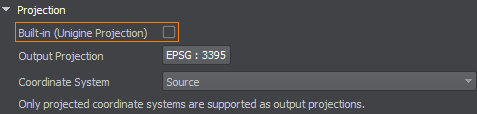
Built-In (Unigine Projection) is an additional option available for the Object Terrain Global format only. The terrain is generated using the projection based on WGS-84 ellipsoid and can be curved.