Generating the Terrain and Objects
As soon as you have added imagery and/or elevation, you are ready to generate a terrain.
The Generation Settings panel is behind the Parameters panel and is accessible by switching the tabs.
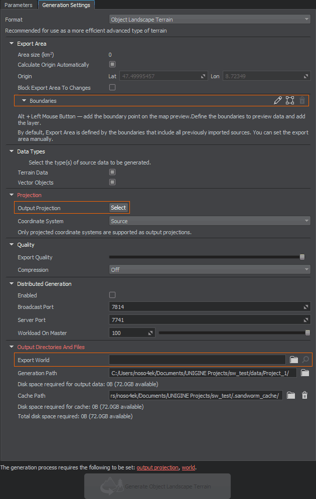
The items required to be set in order to start the terrain generation process, are highlighted red and displayed as clickable links at the bottom.
Export Area#
By default, all imported data are used to generate a terrain. It might take some time depending on the scope of your data.
You can set boundaries for the export area to limit the generated terrain area.
Output Projection#
As you click the Select button for Output Projection, the following window will open:
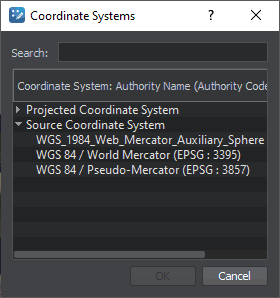
To begin with, double click the Source Coordinate System line and select EPSG:3857 — this is a projection widely used by such services as Google, OpenStreetMap, Navitel, etc. This projection fits almost all georeferenced data except poles.
For more details, see the setting description and the relevant FAQ section.
Export World#
Export World is a world where your terrain will be generated. If you have a world open in UNIGINE Editor, it would be set as the export world automatically. Otherwise, you'll need to (create and) set the world manually.
Generating a Terrain#
If you don't have any issues highlighted red, click the Generate button below and wait until the generation process is finished. A generated terrain is available in the world.
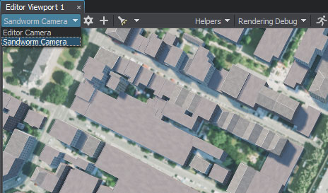
Switch to Sandworm Camera generated with a terrain to immediately observe the created terrain.
Generating Once Again#
Generate the terrain once again if you changed or added the data. You can also regenerate only the selected type of data.
If you changed anything in the generated assets manually (directly in UNIGINE Editor) and then regenerate them, all manual changes will be lost.
What Else#
- Frequently asked questions on Sandworm
- Detailed information on all generation settings