Search the Community
Showing results for tags 'landscape'.
-
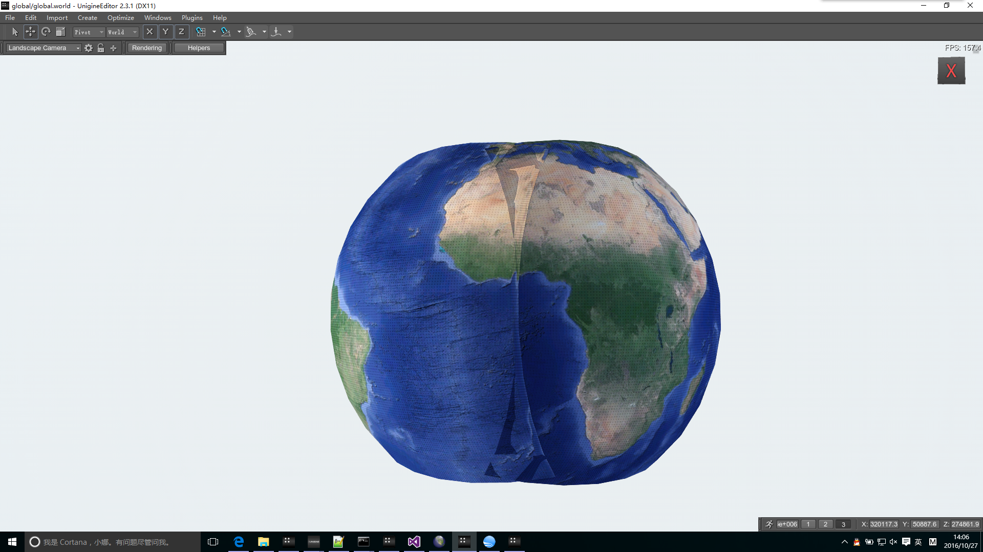
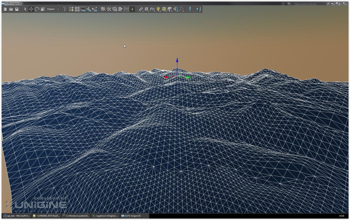
Dear all, We want to use Unigine landscape function generates the whole planet, now there are a few problems need to consult: 1.Different parts of the import data, fusion of overlap area is not very good, is there a way to solve? 2.Can this way is workable?Can this way piece together the world? If we want to generates the whole planet, do you have any better solution? Thanks for you replay!

- 2 replies
-
- 1
-

-
- whole earth
- landscape
- (and 1 more)
-
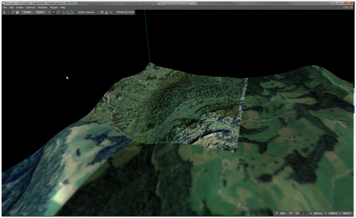
Problem importing external fbx models to a terrain generated with new landscape tool
ivan.cuevas posted a topic in Content Creation
Hi, I've extracted the question from this topic. We are facing similar problems as renato importing data from CityEngine (fbx file) with the terrain generated with the new Landscape tool. This terrain is more or less 10Kmx10Km and looks like there is some scale and rotation offsets between the terrain and the models (in this case buildings). We are creating all our content with UTM projection and datum WGS84. We can work with old Landscape tool at the moment, but we worried when we have to migrate to new Unigine version and the new Landscape tool. Are you preparing some documentation about how we have to export models from 3rd party tools? There are Landscape tool fixes/improvements in the incoming version? From our point of view this is a critical issue (import models from 3rd party tools) to adopt the new Landscape tool. Thanks. -
hi! - when creating normals with landscape-plugin ,.. generated refined normals are always 256px/surface ,imported albedo creates correctly 1k tex, but generated normal only 256 - did i miss something or is there a bug? kind regards Phil
-
[SOLVED] Append imports and changes to existing files
renato.semadeni posted a topic in Content Creation
Hey chaps, Is it possible to append new imported nodes and height changes in the landscape into existing files, such as world file and landscape files? I'd like to change my world generically, save it and load it by an IG with communication. Thanks a lot Renato -
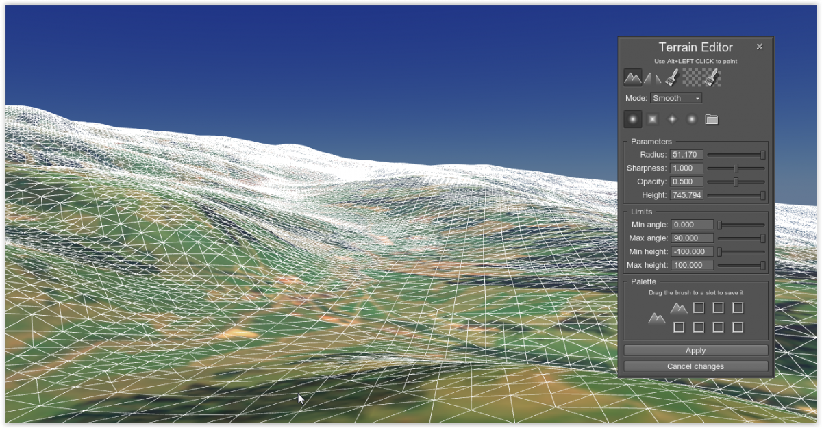
[SOLVED] Terrain editor doesn't change the nodes in landscape
renato.semadeni posted a topic in World Design
Hi there We have a test area build up as a landscape. Now we try to flatten out specific areas to position some larger objects, as airports, runways, ... I tried it with the terrain editor tool, but nothing happens. In the docu is written that "All brushes modify only the refined arean (0-3 LODs)". Is this the problem? Do you propose another approach to flatten areas? Kind regards, Renato
-
Hi there I created a landscape and applied a diffuse texture. If I apply a more detailed texture to the Refined parts, it gets mirrored a long the y (or x?) axis. In the attached picture, I used the same texture for the coarse and the diffuse texture. And as you can see the artefact in the data is mirrored. thanks in advance Renato
-
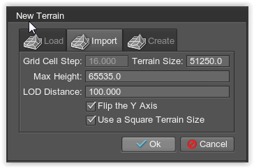
Hi there We extract from different satellites data the height model. F.ex. a 50m resolution means that every pixel on a 1025x1025 picture corresponds to 50m. So the size of the patch is 51250m * 51250m and the height data is as well in meters. When I import this as a new terrain, I have to set the Terrain Size = 51250 and the Max Height = 65535, see the pictures as well. Otherwise, I get a missmatch in the units. In other areas we have a 1km resolution and there is the 1025x1025 picture around 1'025'000m * 1'025'000m... Is there a possibility to modify the units for lat/lon and height separately? I checked the Landscape plugin as well, and there I see the same problem with the units. Thanks for
-
Hi there Everytime I change something in the washington scenery, adding an object for example and then save my changes, I observe a drop in performance about 50%. I track it down, that the landscape.node file is changed in the following lines: Old entry in the landscape node file: <surface name="terrain" material="terrain" property="surface_base"> <material> <state name="terrain">1</state> <state name="detail_0">1</state> <state name="detail_1">1</state> <state name="detail_2">1</state> </material> New entry in the landscape node file: <surface name="terrain" cast_shadow="0" cast_world_shadow="0" intersection_mask="256" material="terrain" property="surface_base"> <material> <state name="detail_0">1</state> <state name="detail_1">1</state> </material> But I don't change anything on the world shadows. Thanks in advance Renato
-
Приветствую! С помощью landscape плагина я создал ландшафт размером 7x7 квадратов. У меня есть карта высот для каждой части ландшафта в формате psd. Когда я пытаюсь выполнить пакетный импорт карты высот получаю ошибку: Error "Loading "landscape/Bagram_hm_%xx_%xy.psd" image". Импорт формата png из этой же директории проходит успешно. Форматы jpg, tif - не импортируются, такая же ошибка. Подскажите, как можно выполнить пакетный импорт карты высот в формате psd? Пути, имена файлов и маска видны на скриншоте во вложении. Machine translation Hello! I have created a terrain with landscape plugin 7x7 size. I have a height map for each part of the terrain in psd format. When I try to run a batch import the height map I receive an error: "Loading "landscape/Bagram_hm_%xx_%xy.psd" image". Import png format of the same directory is successful. Formats jpg, tif - not imported with same error. How to perform a batch import the height map in the format psd? For details see the screenshot in attachment. sreenshot.zip