Search the Community
Showing results for tags 'heightmap'.
Found 3 results
-
Добрый день. Из документации понял, что для записи сгенерированных данных в картинку карты высот в классе Image есть методы: set2D () и перегруженный setPixels (). С первым, благодаря примеру, всё более менее понятно. Со вторым возникли трудности. Создаю файл: image->create2D(lmapTileResolutionX, lmapTileResolutionY, Image::FORMAT_RGBA8); Генерирую и заполняю массив чаров: heightSourceArray = new unsigned char [lmapTileResolutionX * lmapTileResolutionY]; heightSourceArray i = (rand())%255; Вызываю метод image->setPixels(heightSourceArray); В режиме дебага вылетает с необработанным исключением 0x00007FFCDCB3DB9E (ucrtbase.dll) . Так как других ошибок дебагер не выдаёт, идеи куда смотреть закончились. С Уважением, Константин.
-
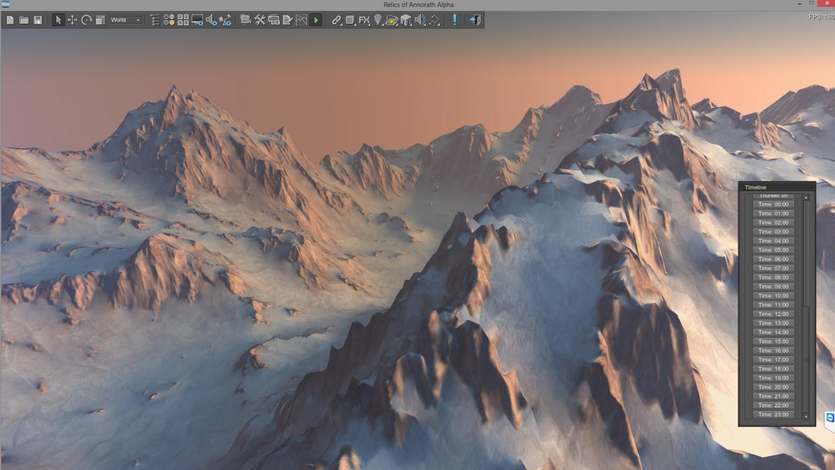
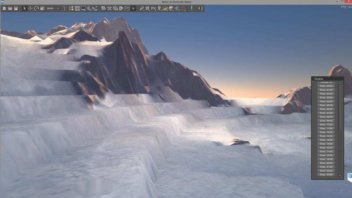
Hello Everyone i encounter a problem in Terrain creation. I tried 16bit, 8bit and various of formats to import heightmap, but i alsways get this like terraced terrain details. from far it looks great, bu tthe detail is very messy. What am i doing wrong? 2 Screenshots of the bumps (close ups) and 2 Screenshots from far away which looks good in my opinion. Terrain is 2049x2049, Step 2, Height 1000. I tried various cimbinations of maps and even in double size of terrain size, or with a 4097x4097 terrain with Step 1, but i can't guess what's wrong. Thanks for tipps in advance! Pascal

-
Приветствую! С помощью landscape плагина я создал ландшафт размером 7x7 квадратов. У меня есть карта высот для каждой части ландшафта в формате psd. Когда я пытаюсь выполнить пакетный импорт карты высот получаю ошибку: Error "Loading "landscape/Bagram_hm_%xx_%xy.psd" image". Импорт формата png из этой же директории проходит успешно. Форматы jpg, tif - не импортируются, такая же ошибка. Подскажите, как можно выполнить пакетный импорт карты высот в формате psd? Пути, имена файлов и маска видны на скриншоте во вложении. Machine translation Hello! I have created a terrain with landscape plugin 7x7 size. I have a height map for each part of the terrain in psd format. When I try to run a batch import the height map I receive an error: "Loading "landscape/Bagram_hm_%xx_%xy.psd" image". Import png format of the same directory is successful. Formats jpg, tif - not imported with same error. How to perform a batch import the height map in the format psd? For details see the screenshot in attachment. sreenshot.zip