Search the Community
Showing results for tags 'world machine'.
Found 2 results
-
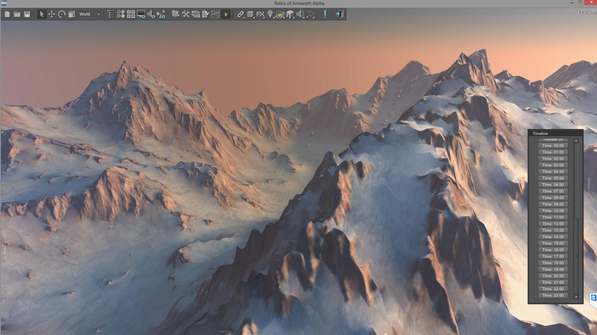
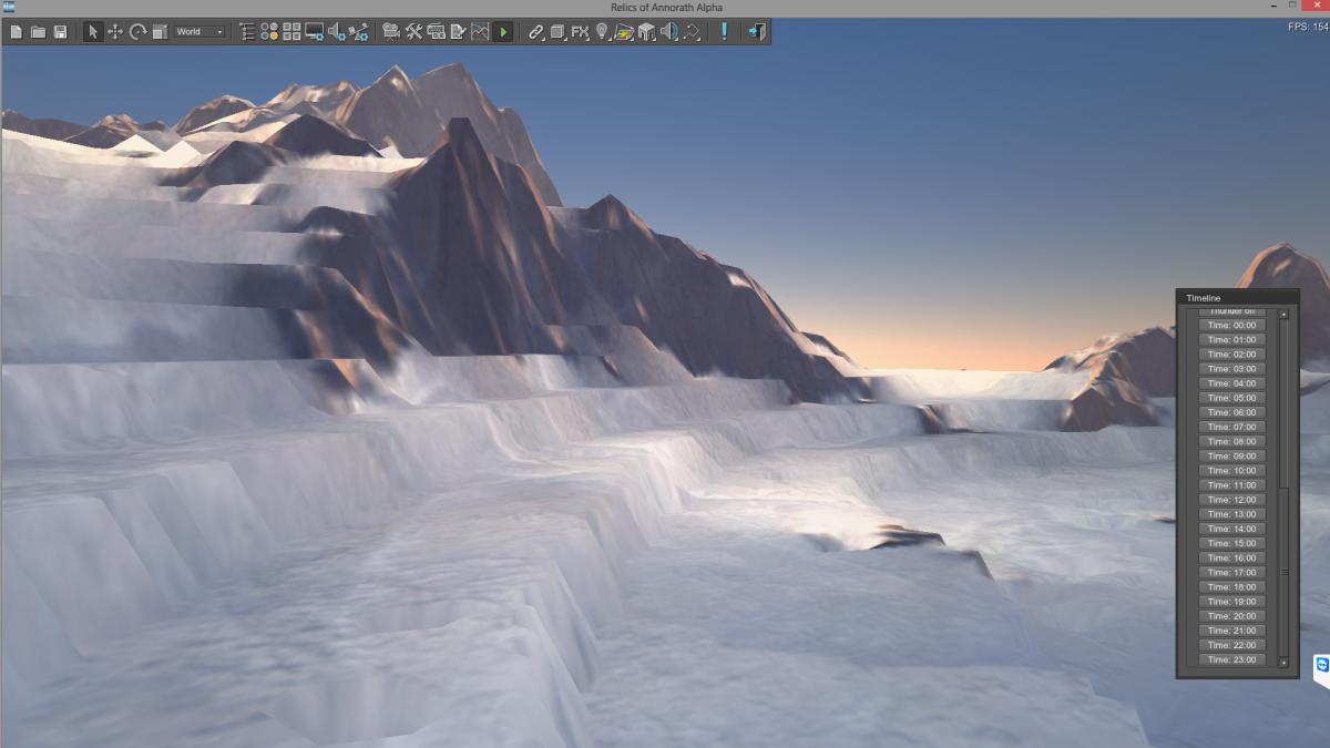
Hello Everyone i encounter a problem in Terrain creation. I tried 16bit, 8bit and various of formats to import heightmap, but i alsways get this like terraced terrain details. from far it looks great, bu tthe detail is very messy. What am i doing wrong? 2 Screenshots of the bumps (close ups) and 2 Screenshots from far away which looks good in my opinion. Terrain is 2049x2049, Step 2, Height 1000. I tried various cimbinations of maps and even in double size of terrain size, or with a 4097x4097 terrain with Step 1, but i can't guess what's wrong. Thanks for tipps in advance! Pascal

-
There is a lot of posts on World Builder as an external terrain creation tool on the forum. I was wondering if anyone had tried Grome as it also looked like a powerful tool with a good range of input and output files? Was the Valley Demo terrain created entirely in Unigine or was World Builder or Grome used? Also, as has been previously discussed, it would be good if Unigine supported import of some of the GIS based gridded, DTM (heightmaps). For example, USGS Digital Elevation Model GeoTIFF Format, Raw, terragen (.ter) kml Google Earth