Search the Community
Showing results for tags 'tiles'.
Found 3 results
-
[SOLVED]Порядок сохранения тайлов при генерации lmap из нескольких тайлов.
Vasara posted a topic in World Design
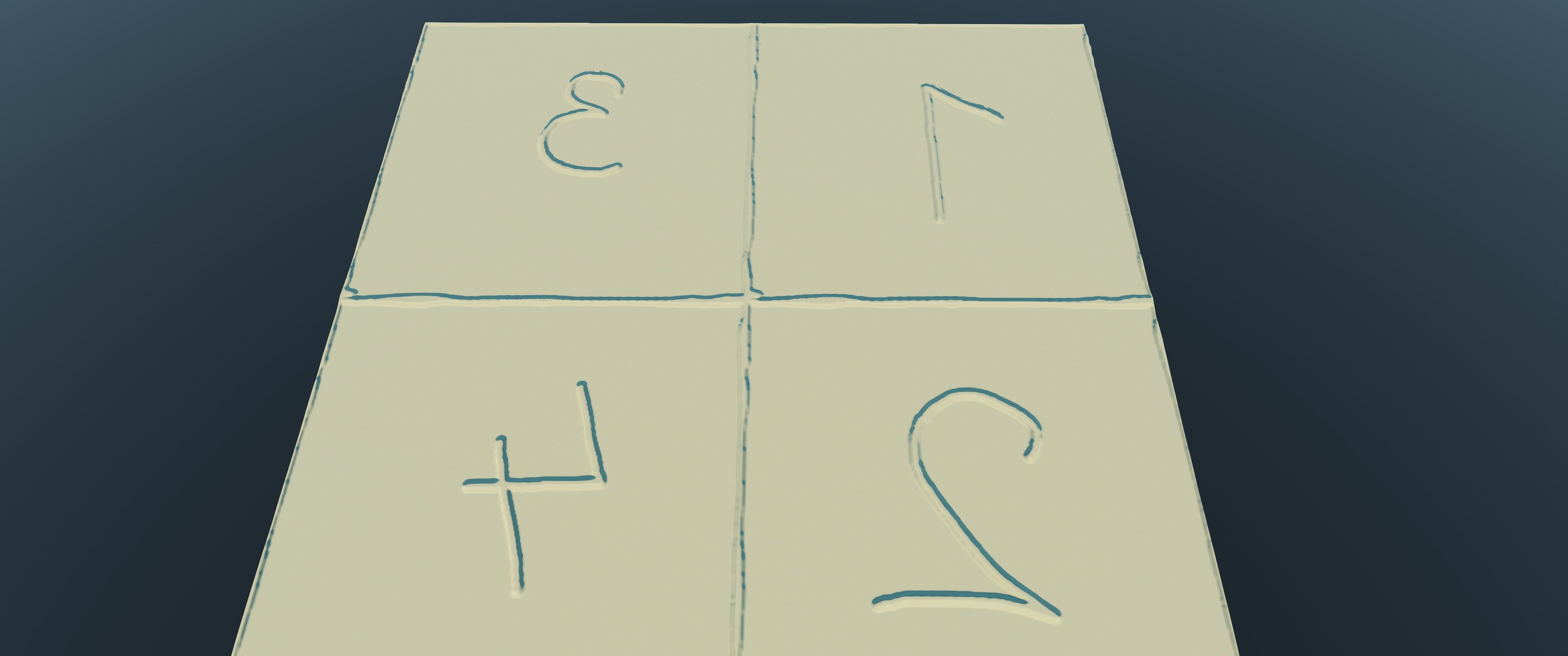
Добрый день. В папке с ресурсами 4 файла тайлов карт высот под именами 1, 2, 3, 4. Содержащие в таком же порядки картинки с цифрами. После генерации карты обычным циклом (1 -> 4) получается очень странный результат. Это такая фича, или я чтото делаю не так? С Уважением, Константин.
-
Добрый день! Пытаюсь собрать lmap из сгенерированных карт высот. Есть несколько не понятных моментов. Как рассчитать высоту? Например при разрешении в 0.25 m/p получится чуть больше пол метра? Есть ли возможность менять высоту тайлов по Z координатной оси? Или же карту можно разрезать как то по другому, чтобы работать с высотой? Что модифицирует scale factor для высот? С Уважением Константин.
-
Hi, i am looking for some suggestions and ideas as to what the best way to approach a problem with multi terrain tiles might be. We use very large multi tiled worlds, consisting of many many seperate terrain tiles. We need to be able to edit these tiles across edges where they join as if they were one tile (otherwise the edges of the tiles will no longer meet up. We plan this to suppot height brushes, detail masks, normal maps - in fact everything that single terrain tiles have in regards to editing capability. If unigine were to tackle such a problem, how would you go about doing this? and do we have the same access in to the terrain system without source code to try and implement something like this? Does anyone else in the community have any ideas about how to tackle this, it certainly does not seem like it will be an easy, and even perhaps an impossible problem to solve with the current system. thanks in advance