Search the Community
Showing results for tags 'map'.
Found 5 results
-
Hello, I have been studying superposition benchmark for content creation and i get knew lot of new stuff from benchmark... thanks for providing such a excellent content benchmark for editor also. I studied contents in benchmark but at that time i checked map also for excellent textures..........and i'm wondering to know that how to create parallax texture. please find attachment of two map albedo and parallax map....... please let me know that how to create parallax map for depth like you created.... for bricks wall in superpostion.. tell me ideas or methods to create parallax map..... regards, mayur patel bricks_alb.dds bricks_h.dds
-
What is the easiest way to query the Latitude / Longitude / Altitude of an object during runtime? I am creating a pseudo map interface using a high altitude ortho camera (looking straight down). I want to drop an object and then write the latitude / longitude / altitude of the object to an xml. I currently do not know the best way to determine these coordinates of the object after it is placed arbitrarily in the world.
-
So, I have a recursive class function with a map, a vector, and a problem Say the function looks like void foo(MyObject bar) { *do stuff with bar* MyObject childObjectMap[]; bar.getChildren(childObjectMap); // clears childObjectMap then copies all of the child objects into it foreach(MyObject obj; childObjectMap) { foo(obj); } } The expected result is that this will traverse each MyObject, do things with it, then get all it's children objects and repeat recursively. What actually happens is that it only does this with the first child. So, even if each MyObject has five children this will only recurse on the first child of the first child. What I found is happening is that each time the ID of ChildObjectMap remains the same so, in essense, it is static. Everytime I call MyObject::getChildren I'm clobbering it so on the return it has the data from the child. So, the question becomes, how do I create a new map or vector to keep a function from treating a map or vector like a static?
-
Are there any examples of how to return a Unigine::vector<Type> back to UnigineScript? It doesn't appear to work in the way that I would expect. C++ ---MyClass.cpp Unigine::Vector<CustomStruct> &getStruct() { return my_struct; } ---Plugin.cpp ExternClass<MyClass> *my_class= MakeExternClass<MyClass>(); my_class->addConstructor(); my_class->addFunction("getStruct",&MyClass::getStruct); Interpreter::addExternClass("MyClass",my_class); UnigineScript MyClass my_class = new MyClass(); CustomStruct structs[] = my_class.getStruct(); Error: Interpreter::parse_expression_array(): "my_class" is not a user array
-
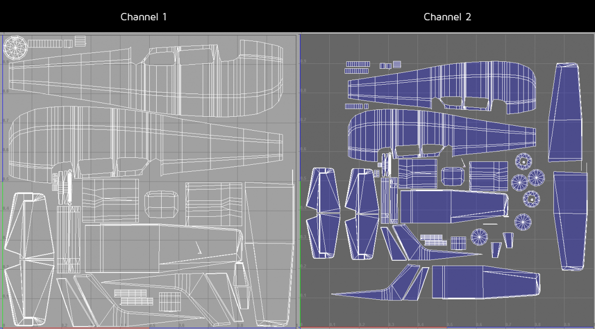
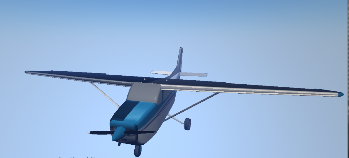
Hey everyone, I'm hoping you can help me. I'm a user of Maya and Max 2014 and I'm having issues with exporting a model plane correctly. I've attached images to help explain my issue. The plane looks correct in the editor when the diffuse and spec maps are applied (Capture5.png), but when I apply the normal map, lots of lighting issues seem to pop up on the model (Capture4.png). In UV channel 1, there are overlapping UVs and some inverted UVs, but I'm doing this to save texture space. Am I right in thinking that as long as the UVs are not overlapping or inverted in channel 2, this should be OK? Also, as a Maya user, I noticed that I'm unable to specify UV channel 1 or 2 when exporting using the Maya plug in. Is this intended, or will there be future updates to resolve this? Thanks a lot for your help! Greg