Search the Community
Showing results for tags 'globalmapper'.
Found 1 result
-
[SOLVED] Vector roads on Landscape not aligned correctly, some missing
josh.trevisiol posted a topic in World Design
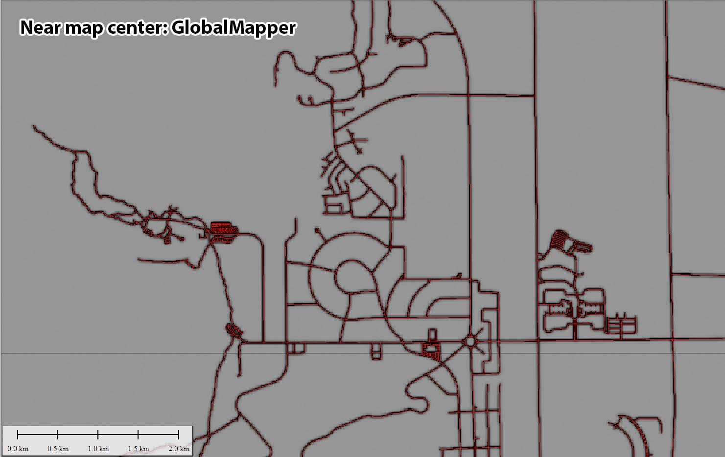
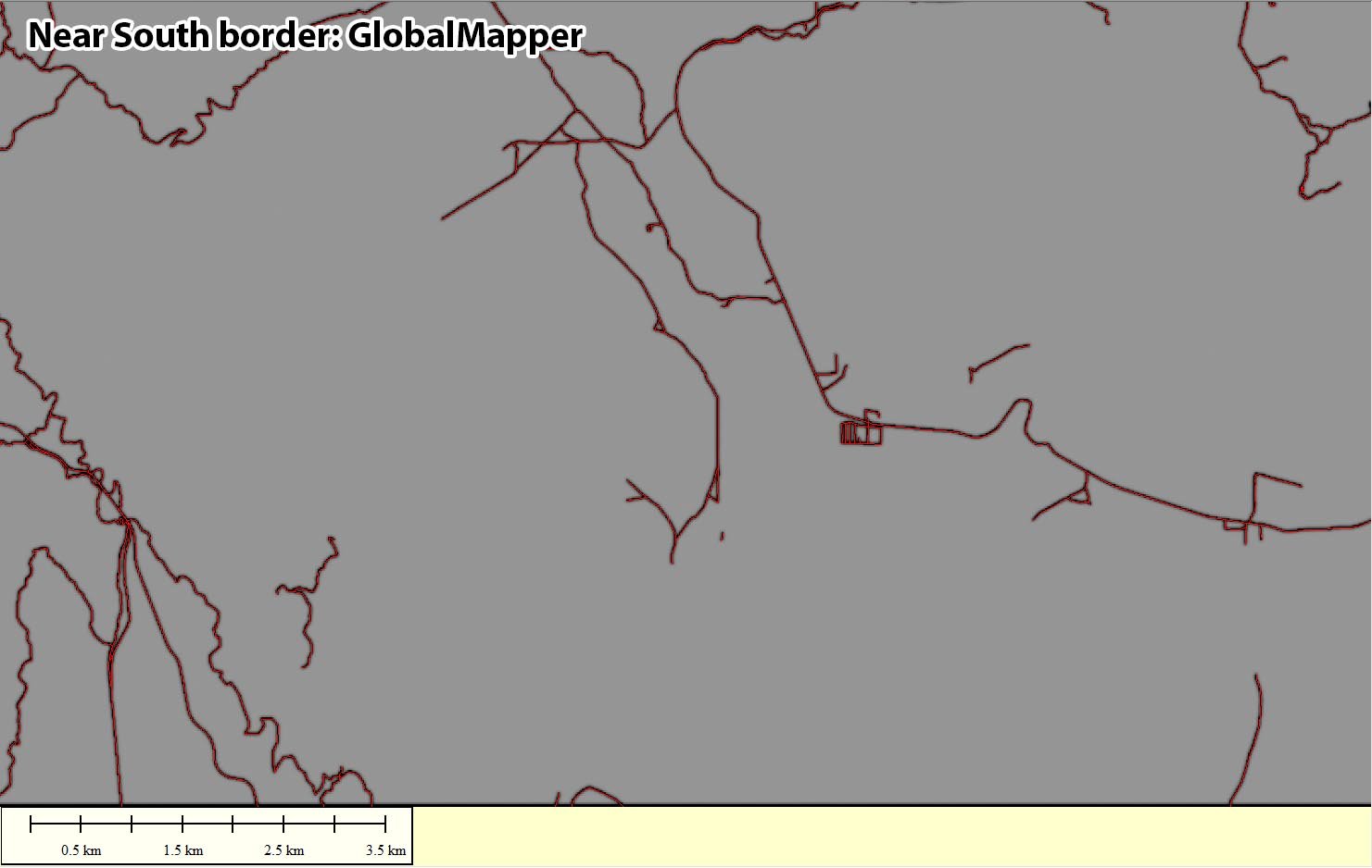
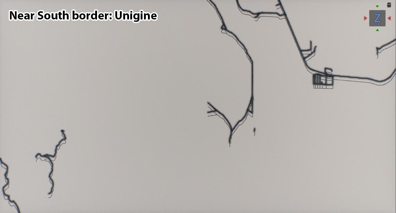
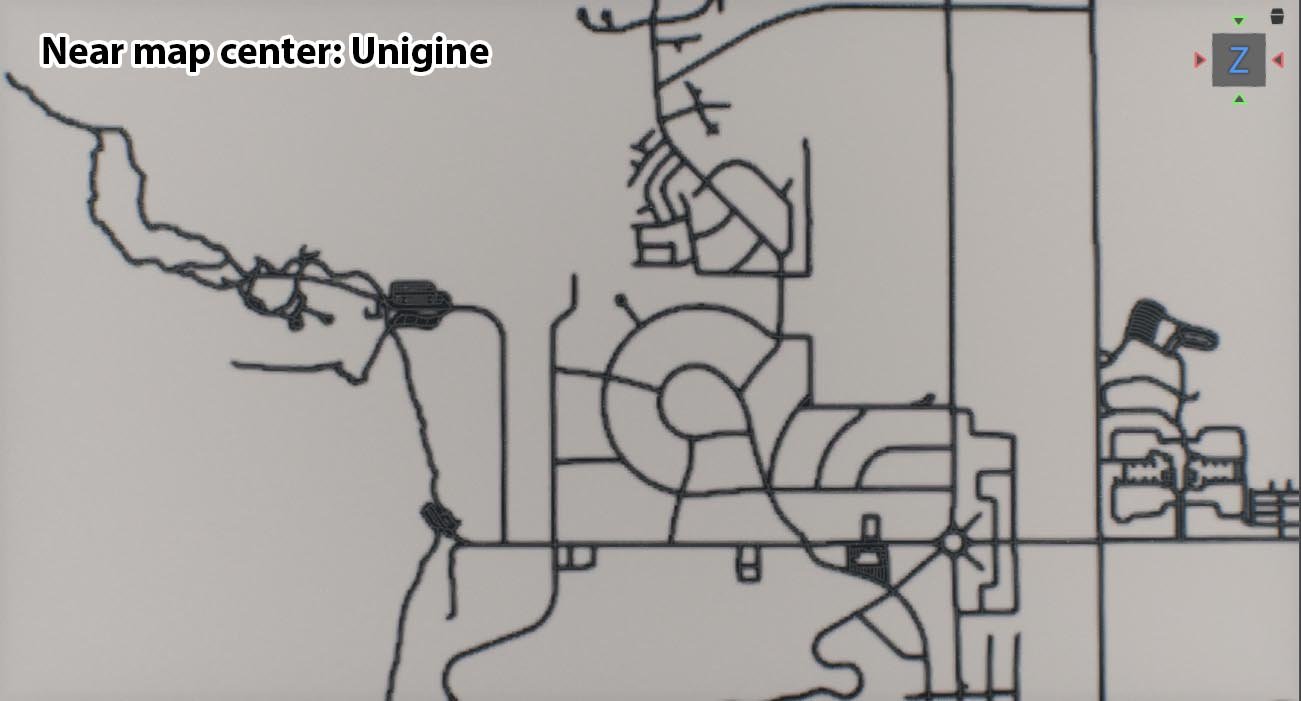
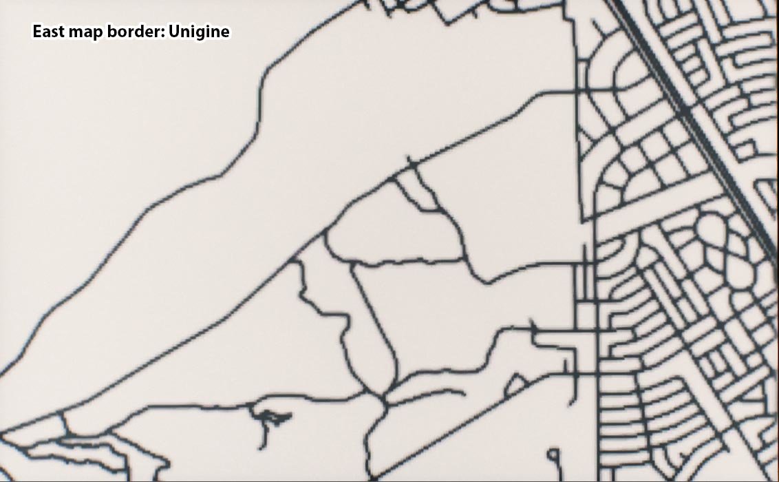
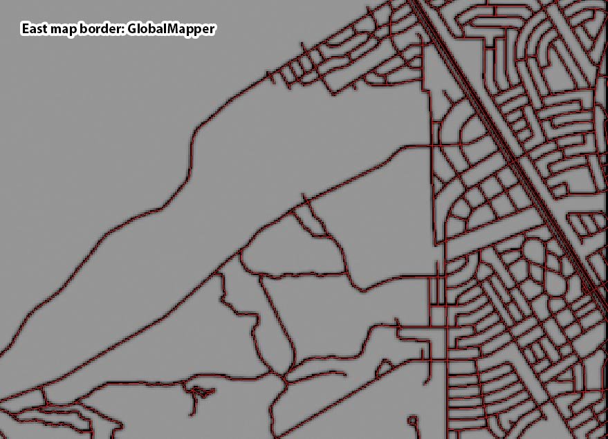
Hello, I'm working to establish a pipeline between GlobalMapper and Unigine 2.7.1 for large scale geo-referenced landscape creation. For GlobalMapper export each data source utilizes Mercator / WGS84 / meters. To test, I am using three data sources: roads.shp, heightmap.tif, and roads_raster.tif. The latter two being Geotiffs that I use in height and albedo to debug. They share the same metadata and I can confirm that their placement relative to each other appears correct. Within GlobalMapper, the data sources line up accurately with the roads.shp across the entire sample area, as I would expect, but in Unigine the roads.shp is offset the further South I go as if it's utilizing a different alignment method than the raster data. It should be noted that when I generate debug vegetation with "Adjust terrain heights and masks" enabled, the result masking is also misaligned with the generated road mesh decals. I am still new to Unigine, so I understand there could be something I'm missing. Any information that can help me to solve my alignment issue would be awesome, Thank you! GlobalMapper showing proper alignment: Unigine with the same data set showing improper alignment, only appearing correct near map center: I'd also like to note that towards the map borders chunks of road from the roads.shp are not being generated by Unigine. GlobalMapper displaying the roads.shp layer as red lines: Unigine displaying no mesh decal roads generated from the above roads.shp: Adjust terrain heights and masks uses the roads.shp but is somehow misaligned with the generated mesh decal roads as well: