Search the Community
Showing results for tags 'CityEngine'.
Found 3 results
-
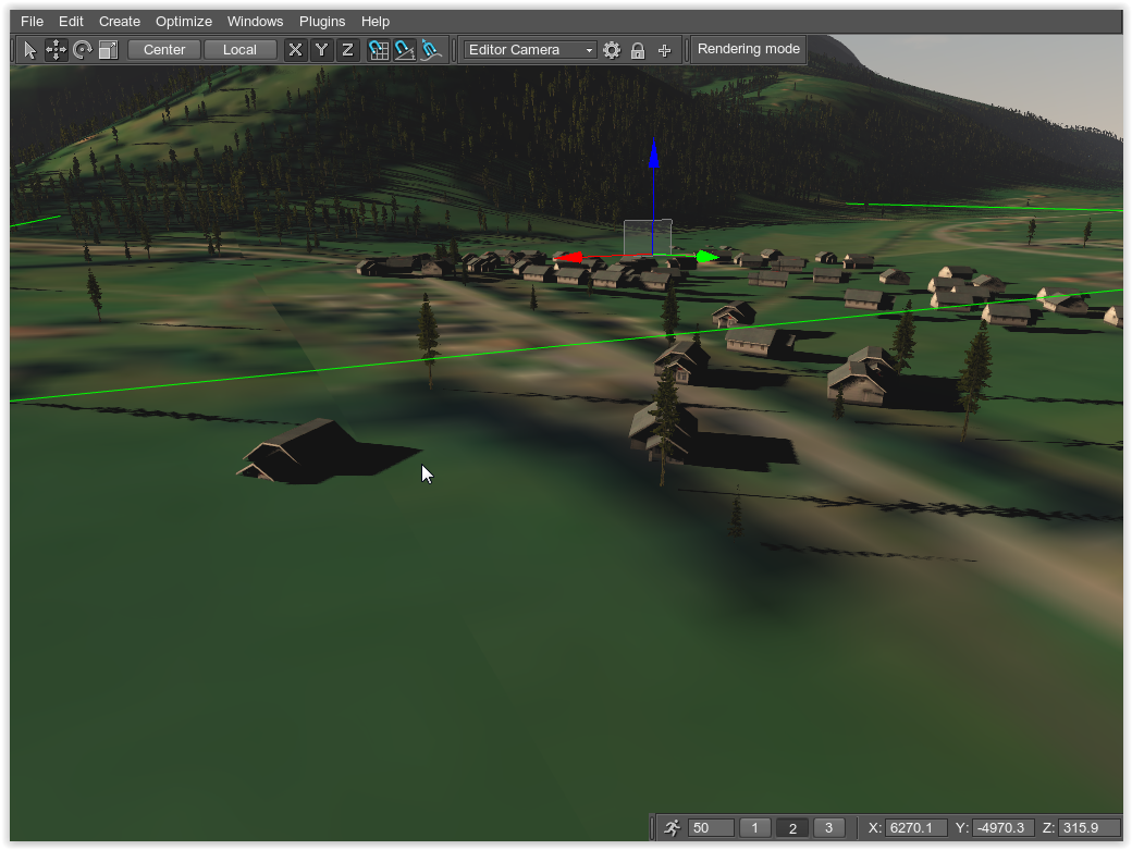
Hi, Unitine We use landscape tool to generate an ObjectGlobalTerrain with images in Beijing 54 Coordinate System(Beijing 1954 3 Degree GK CM 108E), as shown in the following figure. Then we export an model generated with CityEngine inside Unigine. We export the model with EPSG projection:2433 /Beijing 1954. But the model doesn't match the right position in the terrain, as Show in the following figure. We wonder know is there any solution for this problem, because we are developing a software for people to find the longitude and latitude of models. Thanks!
-
Problem importing external fbx models to a terrain generated with new landscape tool
ivan.cuevas posted a topic in Content Creation
Hi, I've extracted the question from this topic. We are facing similar problems as renato importing data from CityEngine (fbx file) with the terrain generated with the new Landscape tool. This terrain is more or less 10Kmx10Km and looks like there is some scale and rotation offsets between the terrain and the models (in this case buildings). We are creating all our content with UTM projection and datum WGS84. We can work with old Landscape tool at the moment, but we worried when we have to migrate to new Unigine version and the new Landscape tool. Are you preparing some documentation about how we have to export models from 3rd party tools? There are Landscape tool fixes/improvements in the incoming version? From our point of view this is a critical issue (import models from 3rd party tools) to adopt the new Landscape tool. Thanks. -
Hi there We're trying to create with the two external tools, Global Mapper and CityEngine, the data for the Unigine's City Plugin. I know this is not the main topic of this forum. But I think for Port Angeles you faced the same problems and used the same tools, and possibly could give us some hints or help. - Did you also export from Global Mapper GeoTiff for the height map used in CityEngine to align the buildings and streets to their correct height? - Which coordinate system and projection did you use as export in Global mapper and as import in CityEngine? - Is there an alternative approach to align the buildings/roads height instead of using the CityEngine? I tried it in Unigine, and I can only change the whole bunch of buildings... Thanks in advance, Renato